Your gateway to endless inspiration
Ecosystems - Blog Posts
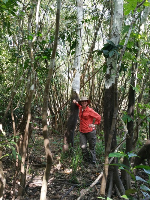
NASA Spotlight: Carbon Cycle and Ecosystems Earth Scientist Erika Podest
Dr. Erika Podest is a scientist with the Carbon Cycle and Ecosystems Group in our Jet Propulsion Laboratory’s Earth Science Division and Visiting Associate Researcher in the Joint Institute for Regional Earth System Science and Engineering (JIFRESSE) at UCLA. Her research entails using satellite images to study Earth’s ecosystems specifically related to wetlands and boreal forests and how they are being affected by climate change.
Erika took time from studying our home planet to answer questions about her life and career! Get to know our Earth Scientist:
What inspires/motivates you?
I am inspired by the beauty of nature, its perfection and by the peace it brings me. My motivation is to make a positive impact on our planet by better understanding it and caring for it.
What first sparked your interest in Earth science?
I was born and raised in Panama, which is a country with an exuberant nature. Since I can remember, I was always surrounded by nature because my father was an adventurer who loved the outdoors and always took me with him to go exploring or simply to enjoy a nice relaxing day outside. This led me to develop a deep sense of appreciation, respect, and curiosity for nature, which sparked my interest to learn about it and pursue a career in Earth Science.
What got you interested in the study of Earth from space?

Early in my college years I was training for my private pilot’s license and during my solo flights I would take pictures of features on the surface from the plane. I was always amazed at the details the pictures showed of the landscape that were not obvious from the ground. This was the first step towards discovering that there was a field for studying Earth from above, called remote sensing and consequently my Masters and Ph.D. were focused in this field.
What technology, discovery, or policy do you think has the most potential to decrease humans’ environmental impact (e.g. wind turbines, carbon taxes, clean meat)?
I don’t think it is a matter of any one technology, discovery or policy. It is a combination of everything. Having an impact on climate change involves every level and direction, from the bottom up at the individual, grassroots and community level to the top down at the policy level. As individuals, I think it is important to educate ourselves about climate change (I suggest climate.nasa.gov). We all have the power to make a positive change by speaking up and making informed decisions about our consumptive habits.
What’s a fact about the role of wetlands and boreal forests in the global ecosystem that you think would surprise people?

Wetlands provide a vital role in carbon storage. Even though they cover about 5-8% of the Earth’s land surface, studies indicate that they contain a disproportionate amount of our planet’s total soil carbon, about 20-30%. In addition, they are like the arteries and veins of the landscape, acting as water sources and purifiers and helping in flood control. They also protect our shores and harbor large amounts of biodiversity.
Boreal forests are found in the uppermost northern hemisphere (Alaska, most of Canada, Russia, Scandinavia and northern Asia) and account for about 30% of the world’s forest cover. These forests lock up enormous amounts of carbon and help slow the increasing buildup of carbon dioxide in our atmosphere. In their peak growth phase during the northern spring and summer, the worldwide levels of carbon dioxide fall and the worldwide levels of oxygen rise.
Can you describe a typical day on a research trip?

It depends on the research trip. For example, one of my more recent ones was to the Peruvian Amazon where we went upriver on a boat for three weeks on a major tributary of the Amazon River called the Ucuyali River. I was with a team of eight researchers and we were studying the wetland ecosystems of the Pacaya-Samiria Natural Reserve, which entailed making vegetation measurements and assessing inundation extent to validate our scientific findings from satellite observations. We camped for most of the trip and a typical day entailed waking up at around 5:00 am with a symphony of sounds that emerged from the forest, including monkeys. We had breakfast and set off from base camp into the forest (~1 hour walk) to work an 8-9 hour day with a short lunch break (we had packed lunches) at noon. At the end of the day I’d be drenched in sweat, sunscreen, insect repellent, and dust and I’d bathe with water from the river, which was as brown as a milk chocolate bar. It was the most refreshing and cleansing feeling! The day would close with dinner followed with a discussion of the measurements to be collected the following day. Lights were out by 7:30 pm (which seemed like midnight) and I’d re-emerge myself into my tent in the dark tropical night surrounded by the sounds of the forest, until the next morning.
What are some of the most important lessons you’ve learned in life?
That it is important to be patient, humble and thankful.
Do you have any secret skills, talents, or hobbies?
Great question! I do not have any secrete skills or talents but I do have a couple of hobbies. I play the piano, though I am still a novice. I love windsurfing. It is an amazing feeling to skim over the water at fast speeds (I’m also an adrenaline junkie). Finally, I am fascinated by magic card tricks and whenever I have some free time I like to learn a new trick.
What do you enjoy the most about your job?
I enjoy constantly learning about our natural world and how it works. I also really enjoy communicating my work to students and to the general public. I find it especially rewarding when I can educate people and motivate students to consider careers in science.
Erika, thank you for your time and everything you do to keep our home planet safe!
Make sure to follow us on Tumblr for your regular dose of space: http://nasa.tumblr.com.
Let It Snow for Science
When the weather outside is frightful…
Science in the field gets even more delightful. Two different missions are in the field right now, studying snow and how it affects communities around the country.
From our Wallops Flight Facility in Virginia, the IMPACTS mission is flying up and down the East Coast, investigating how snow forms inside clouds. In Grand Mesa, Colorado, SnowEx’s teams on the ground and in the air are taking a close look at how much water is stored in snow.

Hate going out in the storm? The IMPACTS mission can help with that! IMPACTS uses two planes – a P-3 Orion and an ER-2 – flying through and high above the clouds to study where intense bands of snowfall form. Better understanding where intense snow will fall can improve forecast models down the road — helping prepare communities for snowstorms.

Cameras mounted on the wings of the P3 took microscopic images of snowflakes, like this one.

At the same time, the SnowEx team is in Colorado, studying the depth and density of snow. Researchers are making radar spirals with snowmobiles and working in giant snow pits to measure things like snow water equivalent, or how much water is stored in snow.

SnowEx is helping us better understand snow’s role in ecosystems and human systems, like irrigation for agriculture. If you want to bring some corn for popping, SnowEx’s science can help grow that crop.

Follow along with our teams as they brave the cold and snow: https://twitter.com/nasaexpeditions
Make sure to follow us on Tumblr for your regular dose of space: http://nasa.tumblr.com
Smoke Gets In Your Eyes…and Our Instruments
Fires are some of the most dynamic and dramatic natural phenomena. They can change rapidly, burning natural landscapes and human environments alike. Fires are a natural part of many of Earth’s ecosystems, necessary to replenish soil and for healthy plant growth. But, as the planet warms, fires are becoming more intense, burning longer and hotter.

Right now, a fleet of vehicles and a team of scientists are in the field, studying how smoke from those fires affects air quality, weather and climate. The mission? It’s called FIREX-AQ. They’re working from the ground up to the sky to measure smoke, find out what’s in it, and investigate how it affects our lives.

Starting on the ground, the Langley Aerosol Research Group Experiment (LARGE) operates out of a large van. It’s one of two such vans working with the campaign, along with some other, smaller vans. It looks a little like a food truck, but instead of a kitchen, the inside is packed full of science instruments.

The team drives the van out into the wilderness to take measurements of smoke and tiny particles in the air at the ground level. This is important for a few reasons: First of all, it’s the stuff we’re breathing! It also gives us a look at smoke overnight, when the plumes tend to sink down out of the atmosphere and settle near the ground until temperatures heat back up with the Sun. The LARGE group camps out with their van full of instruments, taking continuous measurements of smoke…and not getting much sleep.

Just a little higher up, NOAA’s Twin Otter aircraft can flit down close to where the fires are actually burning, taking measurements of the smoke and getting a closer look at the fires themselves. The Twin Otters are known as “NOAA’s workhorses” because they’re easily maneuverable and can fly nice and slow to gather measurements, topping out at about 17,000 feet.

Then, sometimes flying at commercial plane height (30,000 feet) and swooping all the way down to 500 feet above the ground, NASA’s DC-8 is packed wing to wing with science instruments. The team onboard the DC-8 is looking at more than 500 different chemicals in the smoke.

The DC-8 does some fancy flying, crisscrossing over the fires in a maneuver called “the lawnmower” and sometimes spiraling down over one vertical column of air to capture smoke and particles at all different heights. Inside, the plane is full of instrument racks and tubing, capturing external air and measuring its chemical makeup. Fun fact: The front bathroom on the DC-8 is closed during science flights to make sure the instruments don’t accidentally measure anything ejected from the plane.

Finally, we make it all the way up to space. We’ve got a few different mechanisms for studying fires already mounted on satellites. Some of the satellites can see where active fires are burning, which helps scientists and first responders keep an eye on large swaths of land.

Some satellites can see smoke plumes, and help researchers track them as they move across land, blown by wind.

Other satellites help us track weather and forecast how the fires might behave. That’s important for keeping people safe, and it helps the FIREX-AQ team know where to fly and drive when they’ll get the most information. These forecasts use computer models, based on satellite observations and data about how fires and smoke behave. FIREX-AQ’s data will be fed back into these models to make them even more accurate.

Learn more about how NASA is studying fires from the field, here.
Make sure to follow us on Tumblr for your regular dose of space: http://nasa.tumblr.com.