Your gateway to endless inspiration
GPS - Blog Posts
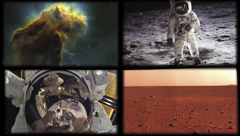
10 Ways the 2010s Pushed Communication and Navigation into the Future!
We transmit vast amounts of data from space, letting all of our satellites “phone home.” Imagery from far off regions of our solar system, beautiful visions of other galaxies and insights into planet Earth flow through our communications networks.
Our Space Communications and Navigation (SCaN) program is dedicated to making sure we precisely track, command and control our spacecraft. All the while, they develop bold new technologies and capabilities for Artemis – our sustainable lunar exploration program that will place the first woman and the next man on the Moon in 2024.
As we prepare to say goodbye to the 2010s, let’s take a look at 10 of the biggest milestones in space communications and navigation of the past decade.
1. Continuous global communications? TDRS has you covered.

From 2013 to 2017, we launched three Tracking and Data Relay Satellites, or TDRS for short. These new satellites replenished a fleet that has been around since the early 1980s, allowing us to provide continuous global communications coverage into the next decade. Missions like the International Space Station depend on TDRS for 24/7 coverage, allowing our astronauts to call home day or night.
2. Binge watching on the Moon? Laser communications will make it possible.

Imagine living at the Moon. With the Artemis program, we’re making it happen! However, we can’t live there without decent internet, right? In 2013, we conducted the Lunar Laser Communication Demonstration (LLCD). This was the first high-speed laser communications demonstration from the Moon, transmitting data at a whopping 622 megabits per second, which is comparable to many high-speed fiber-optic connections enjoyed at home on Earth! Our LLCD sent back high-definition video with no buffering.
3. Record Breaking GPS navigation, at your service.
Space communications is just one piece of the SCaN puzzle. We do navigation too! We even break records for it. In 2016, our Magnetospheric Multiscale (MMS) mission broke the world record for highest altitude GPS fix at 43,500 miles above Earth. In 2017, they broke it again at 93,200 miles. Earlier this year, they broke it a third time at 116,200 miles from Earth — about halfway to the Moon!
Thanks to MMS, our navigation engineers believe that GPS and similar navigation constellations could play a significant role in the navigation architecture of our planned Gateway spaceship in lunar orbit!
4. Crashing planes as part of the game – of research!

Then there was that one summer we crashed three planes in the name of research! In 2015, our Search and Rescue office tested crash scenarios at Langley Research Center’s Landing and Impact Research Facility to improve the reliability of emergency beacons installed in planes. After the study, we made recommendations on how pilots should install these life-saving beacons, increasing their chances of survival in the event of a crash. The Federal Aviation Administration adopted these recommendations this year!
5. The Deep Space Atomic Clock takes flight.

Missions venturing into deep space want the autonomy to make decisions without waiting for a commands from Earth. That’s why we launched the Deep Space Atomic Clock this past year. This itty-bitty technology demonstration is a small, ultra-stable timekeeping device that could enable autonomous navigation!
6. 50 never looked so good – for our Deep Space Network.

In 2013, our Deep Space Network celebrated its 50th birthday! This is the network that transmitted Neil Armstrong’s famous words, "That's one small step for (a) man, one giant leap for mankind." Some of its more recent accomplishments? Gathering the last bits of data before Cassini dove into Saturn’s upper atmosphere, pulling down the “heart” of Pluto and talking to the Voyager probes as they journeyed into interstellar space!
7. SCaN Testbed becomes an official Hall of Famer.

In 2012, we installed the SCaN Testbed, which looks like a blue box in the above picture, on the space station! We built the testbed out of Software Defined Radios, which can change their functionality and employ artificial intelligence. These radios will help us adapt to the increasingly crowded communications landscape and improve the efficiency of radio technology. The Testbed was so ground-breaking that it was inducted into the Space Technology Hall of Fame in 2019.
8. Moon mission communications system, secured!

Just a few weeks ago, we held a ribbon-cutting for the Near Earth Network’s Launch Communications Segment, which will support Artemis missions as they rocket toward the Moon! During initial, dynamic phases of launch, the segment’s three stations will provide communications between astronauts and mission controllers, giving them the data necessary to ensure crew safety.
9. Deep Space Station antenna introduces “beam waveguide” technology.

On October 1, 2014, in Canberra, Australia, the Deep Space Network’s Deep Space Station 35 (DSS-35) antenna went operational. It was the first of a number of new antennas built to support the growing number of deep space missions! The antenna is different from other antennas that were built before it. Older antennas had a lot of their equipment stored high up on the antenna above the dish. DSS-35 uses “beam waveguide” technology that stores that equipment underground. This makes the weight sitting on the dish much lighter, cuts down on interference and makes the antenna much easier to operate and maintain.
10. Hello, Alaska!

Last — but certainly not least — we expanded our presence in the 49th state, Alaska! While this picture might look like antennas rising from the forests of Endor, the one in the foreground is actually an antenna we installed in 2014 in partnership with the University of Alaska Fairbanks. Because of its proximity to the polar north, this 11-meter beauty is uniquely situated to pull down valuable Earth science data from our polar-orbiting spacecraft, contributing to scientists’ understanding of our changing planet!
Make sure to follow us on Tumblr for your regular dose of space: http://nasa.tumblr.com.
GPS: Coming to a Moon Near You!

The next generation of lunar explorers – the Artemis generation – will establish a sustained presence on the Moon, making revolutionary discoveries, prospecting for resources and proving technologies key to future deep space exploration. To support these ambitions, our navigation engineers are developing an architecture that will provide accurate, robust location services all the way out to lunar orbit.
How? We’re teaming up with the U.S. Air Force to extend the use of GPS in space by developing advanced space receivers capable of tracking weak GPS signals far out in space.

Spacecraft near Earth have long relied on GPS signals for navigation data, just as users on the ground might use their phones to maneuver through a highway system. Below approximately 1,860 miles, spacecraft in low-Earth orbit can rely on GPS for near-instantaneous location data. This is an enormous benefit to these missions, allowing many satellites the autonomy to react and respond to unforeseen events without much hands-on oversight.

Beyond this altitude, navigation becomes more challenging. To reliably calculate their position, spacecraft must use signals from the global navigation satellite system (GNSS), the collection of international GPS-like satellite constellations. The region of space that can be serviced by these satellites is called the Space Service Volume, which extends from 1,860 miles to about 22,000 miles, or geosynchronous orbit.

In this area of service, missions don’t rely on GNSS signals in the same way one would on Earth or in low-Earth orbit. They orbit too high to “see” enough signals from GNSS satellites on their side of the globe, so they must rely on signals from GNSS satellite signals spilling over to the opposite side of the globe. This is because the Earth blocks the main signals of these satellites, so the spacecraft must “listen” for the fainter signals that extend out from the sides of their antennas, known as “side-lobes.”

Though 22,000 miles is considered the end of the Space Service Volume, that hasn’t stopped our engineers from reaching higher. In fact, our simulations prove that GNSS signals could even be used for reliable navigation in lunar orbit, far outside the Space Service Volume, over 200,000 miles from Earth. We’re even planning to use GNSS signals in the navigation architecture for the Gateway, an outpost in orbit around the Moon that will enable sustained lunar surface exploration.

It’s amazing that the same systems you might use to navigate the highways are putting us on the path forward to the Moon!
Make sure to follow us on Tumblr for your regular dose of space: http://nasa.tumblr.com.
High-Flying Spacecraft Finish 1000th Lap Around Earth!
The quadruplet spacecraft of the Magnetospheric Multiscale mission have just returned from their first adventure into the solar wind — sailing through the most intense winds of their journey so far.

These spacecraft were designed to study Earth’s giant magnetic system, which shields our planet from the majority of the Sun’s constant outflow of material — what we call the solar wind.

Usually, the Magnetospheric Multiscale spacecraft — MMS for short — take their measurements from inside Earth’s protective magnetic environment, the magnetosphere. But in February and March, the MMS spacecraft ventured beyond this magnetic barrier to measure that solar wind directly — a feat that meant they had to change up how they fly in a whole new way.

Outside of Earth's protective magnetic field, the spacecraft were completely immersed in the particles and magnetic fields of the solar wind. As they flew through the stream of material, the spacecraft traced out a wake behind each instrument, just like a boat in a river. To avoid measuring that wake, each spacecraft was tilted into the wind so the instruments could take clean measurements of the pristine solar wind, unaffected by the wake.

Within the magnetosphere, the MMS spacecraft fly in a pyramid-shaped formation that allows them to study magnetic fields in 3D. But to study the solar wind, the mission team aligned spacecraft in a straight line at oddly spaced intervals. This string-of-pearls formation gave MMS a better look at how much the solar wind varies over different scales.

Because the four spacecraft fly so close together, MMS relies on super-accurate navigation from GPS satellites. This venture into the solar wind took the spacecraft even farther from Earth than before, so MMS broke its own world record for highest-ever GPS fix. The spacecraft were over 116,000 miles above Earth — about halfway to the Moon — and still using GPS!

Now, just in time for the 1,000th orbit of their mission — which adds up to 163 million miles flown! — the spacecraft are back in Earth's magnetosphere, flying in their usual formation to study fundamental processes within our planet’s magnetic field.
Keep up with the latest MMS research at nasa.gov/mms, on Twitter @NASASun or with NASA Sun Science on Facebook.
Make sure to follow us on Tumblr for your regular dose of space: http://nasa.tumblr.com
A Hitchhiker’s Ride to Space
This month, we are set to launch the latest weather satellite from the National Oceanic and Atmospheric Administration (NOAA). The Joint Polar Satellite System-1, or JPSS-1, satellite will provide essential data for timely and accurate weather forecasts and for tracking environmental events such as forest fires and droughts.

Image Credit: Ball Aerospace
JPSS-1 is the primary satellite launching, but four tiny satellites will also be hitchhiking a ride into Earth orbit. These shoebox-sized satellites (part of our CubeSat Launch Initiative) were developed in partnership with university students and used for education, research and development. Here are 4 reasons why MiRaTA, one of the hitchhikers, is particularly interesting…

Miniaturized Weather Satellite Technology
The Microwave Radiometer Technology Acceleration (MiRaTA) CubeSat is set to orbit the Earth to prove that a small satellite can advance the technology necessary to reduce the cost and size of future weather satellites. At less than 10 pounds, these nanosatellites are faster and more cost-effective to build and launch since they have been constructed by Principal Investigator Kerri Cahoy’s students at MIT Lincoln Laboratory (with lots of help). There’s even a chance it could be put into operation with forecasters.

The Antenna? It’s a Measuring Tape
That long skinny piece coming out of the bottom right side under MiRaTA’s solar panel? That’s a measuring tape. It’s doubling as a communications antenna. MiRaTA will measure temperature, water vapor and cloud ice in Earth’s atmosphere. These measurements are used to track major storms, including hurricanes, as well as everyday weather. If this test flight is successful, the new, smaller technology will likely be incorporated into future weather satellites – part of our national infrastructure.

Tiny Package Packing a Punch MiRaTA will also test a new technique using radio signals received from GPS satellites in a higher orbit. They will be used to measure the temperature of the same volume of atmosphere that the radiometer is viewing. The GPS satellite measurement can then be used for calibrating the radiometer. “In physics class, you learn that a pencil submerged in water looks like it’s broken in half because light bends differently in the water than in the air,” Principal Investigator Kerri Cahoy said. “Radio waves are like light in that they refract when they go through changing densities of air, and we can use the magnitude of the refraction to calculate the temperature of the surrounding atmosphere with near-perfect accuracy and use this to calibrate a radiometer.”

What’s Next?
In the best-case scenario, three weeks after launch MiRaTA will be fully operational, and within three months the team will have obtained enough data to study if this technology concept is working. The big goal for the mission—declaring the technology demonstration a success—would be confirmed a bit farther down the road, at least half a year away, following the data analysis. If MiRaTA’s technology validation is successful, Cahoy said she envisions an eventual constellation of these CubeSats orbiting the entire Earth, taking snapshots of the atmosphere and weather every 15 minutes—frequent enough to track storms, from blizzards to hurricanes, in real time.
Learn more about MiRaTA
Watch the launch!

The mission is scheduled to launch this month (no sooner than Nov. 14), with JPSS-1 atop a United Launch Alliance (ULA) Delta II rocket lifting off from Space Launch Complex 2 at Vandenberg Air Force Base in California. You’ll be able to watch on NASA TV or at nasa.gov/live.

Watch the launch live HERE on Nov. 14, liftoff is scheduled for Tuesday, 4:47 a.m.!
Make sure to follow us on Tumblr for your regular dose of space: http://nasa.tumblr.com.
10 Out of this World NASA Spinoff Technologies
What is a spinoff? Great question! A NASA spinoff is a technology, originally developed to meet our mission needs that has been transferred to the public and now provides benefits as a commercial product or service. Basically, we create awesome stuff and then share it with the world. Here’s a list of just a few NASA spinoff technologies (in no particular order):
1. Enriched Baby Food

While developing life support for Mars missions, NASA-funded researchers discovered a natural source for an omega-3 fatty acid that plays a key role in infant development. The ingredient has since been infused in more than 99% of infant formula on the market and is helping babies worldwide develop healthy brains, eyes and hearts.
2. Digital Camera Sensors
Whether you take pictures and videos with a DSLR camera, phone or even a GoPro, you’re using NASA technology. The CMOS active pixel sensor in most digital image-capturing devices was invented when we needed to miniaturize cameras for interplanetary missions.
3. Airplane Wing Designs

Did you know that we’re with you when you fly? Key aerodynamic advances made by our researchers - such as the up-turned ends of wings, called “winglets” - are ubiquitous among modern aircraft and have saved many billions of dollars in fuel costs.
4. Precision GPS

Uncorrected GPS data can be off by as much as 15 meters thanks to data errors, drift in satellite clocks and interference from Earth’s atmosphere. One of our software packages developed in the 1990s dials in these locations to within centimeters, enabling highly accurate GPS readings anywhere on the planet. One of our most important contributions to modern society, precise GPS is used in everything from personal devices and commercial airplanes to self-driving tractors.
5. Memory Foam

Possibly the most widely recognized spinoff, memory foam was invented by our researchers looking for ways to keep its test pilots and astronauts comfortable as they experienced extreme acceleration. Today, memory foam cushions beds, chairs, couches, car and motorcycle seats, shoes and even football helmets.
6. International Search and Rescue System

We pioneered the technology now used internationally for search and rescue operations. When pilots, sailors or other travelers and adventurers are stranded, they can activate a personal locator bacon that uses overhead satellites to relay their call for help and precise location to authorities.
7. Improvements to Truck Aerodynamics

Nearly every truck on the road has been shaped by NASA - literally. Agency research in vehicle aerodynamic design led to the curves and contours that help modern big rigs cut through the air with less drag. Our contributions to truck design have greatly reduced fuel consumption, perhaps by as much as 6,800 gallons per year for an average vehicle.
8. Shock Absorbers for Buildings and Bridges

Shock absorbers originally designed to survive the extreme conditions of space shuttle launches are now bracing hundreds of buildings and bridges in earthquake-prone regions all over the world. None of which have suffered even minor damage during an earthquake.
9. Advanced Water Filtration

We have recently discovered sources of water on the moon and Mars, but even so space is still practically a desert for human explorers, and every drop possible must be recycled and reused. A nanofiber filer devised to purify water in orbit is currently at work on Earth. From devices that supply water to remote villages, to a water bottle that lets hikers and adventurers stay hydrated using streams and lakes, our technology is being utilized.
10. Invisible Braces

A company working with NASA invented the translucent ceramic that became the first invisible dental braces, which would go on to become one of the best-selling orthodontic products of all time.
So, now that you know a few of the spinoff technologies that we helped develop, you can look for them throughout your day. Visit our page to learn about more spinoff technologies: https://spinoff.nasa.gov
Make sure to follow us on Tumblr for your regular dose of space: http://nasa.tumblr.com