Your gateway to endless inspiration
Landsat - Blog Posts
Countdown to Launch of Landsat 9
We’re launching Landsat 9 — the ninth in a series of satellite missions from NASA and the U.S. Geological Survey (USGS) that have been collecting images of our planet for almost 50 years. Follow along as we count down to launch!

A normal launch countdown starts at 10, but for Landsat 9, we’re jumping in with L-9!
There are 9 million images in the USGS/NASA Landsat archive! They’re all available for free, for use by scientists, data managers, and anyone else who’s interested. You can even download them!

Landsat 9 won’t be orbiting alone. Working together, Landsat 9 and Landsat 8 will completely image Earth every 8 days! This helps us track changes on the planet’s surface as they happen in near-real-time.

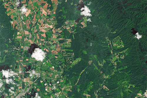
Landsat sees all 7 continents! From Antarctic ice to growing cities to changing forests, Landsat measures land — and coastal regions — all around the globe.

Working in space is really hard. Landsat 6 never made it to orbit, an important reminder that failures can be opportunities to learn and grow. Shortly after the unsuccessful launch, engineers got to work on Landsat 7, which is still collecting data today — 22 years later.

We have 5 decades of Landsat observations, the longest continuous record of Earth’s land surfaces in existence! While building the original Landsat in the 1970s, it would have been hard to imagine that this mission would still be providing crucial data about our planet today.

For each color band collected, Landsat 9 will see 4 times the shades of light as the previous Landsat mission! With more than 16,000 different intensities detected, Landsat 9 will be able to see crucial details on our planet’s surface.

Our eyes detect 3 colors of light: red, green, and blue — and Landsat does too! But Landsat 9 also detects wavelengths that can be combined to measure things our eyes can’t, like crop stress, coral reef health, fires, and more.

There are 2 instruments on Landsat 9! The Operational Land Imager 2 collects light, and works kind of like our eyes — or cameras — to make data-rich images. The Thermal Infrared Sensor 2 measures temperature, helping monitor plant health, fires, and more.

The Landsat program is the result of 1 amazing partnership! For more than 50 years, we’ve worked with the U.S. Geological Survey to design, build, launch, and manage Landsat satellites.

Two agencies working together makes for the longest continuous record of Earth’s surfaces. Now, let’s launch this satellite!
Make sure to follow us on Tumblr for your regular dose of space!
Take a Road Trip through Time with Landsat 9
A lot can change in five decades! How we talk, what we wear – it all evolves. But one thing that’s stayed consistent is our unique view of our home planet from above. Five decades ago, we at NASA partnered with United States Geological Survey (USGS) to launch a satellite called Landsat to see Earth from space. Now, we’re launching Landsat 9 – that’s right, the ninth in the series!

Join us for a road trip through the decades from the idea of an Earth-imaging satellite in the groovy 60s to the launch of Landsat 9 this year. Hop in!

The 60s
Far out! In 1966, USGS proposed a satellite to image land all around our planet. Researchers worked with our scientists and engineers to design the satellite and figure out how it would work.

The 70s
Here’s the lowdown: In 1970, we got approval to build the Earth Resources Technology Satellite, later renamed Landsat 1. The satellite launched in 1972 and provided the first digital data of Earth, repeated at regular intervals, which allows us to see changes as they happen.

The 80s
In 1982, we launched Landsat 4, followed by Landsat 5 in 1984. These two satellites collected more wavelengths of light at higher precision, allowing for natural color images, which is totally radical, dude.

The 90s
Wasssup, 1990s? Landsat 7 launched this decade, collecting even more data than previous Landsat satellites, enough to produce the first hi-res natural color map of remote Antarctica.

The 2000s
In 2008, our partners at USGS made all Landsat data available for free. This gave peeps around the world access to all the data they needed, unlocking innovation and creating economic benefits, like the ability to track crop health from space. Sweet!

The 2010s
In 2013, Landsat 8 began the modern era of Landsat observations. A new style of sensor and ground system made it possible to download much more and better data than ever before. Plus, a partnership with European Space Agency’s Sentinel-2 satellites gives even more regular observations. We heart that!

The 2020s
Now, we’re set to launch Landsat 9, a twin to Landsat 8. Two Landsat satellites with two instruments each will highkey change our view of Earth once again.

Now, on to the next 50 years of Earth observations! Stay tuned to watch Landsat 9 launch and start telling us even more about our home planet.
Make sure to follow us on Tumblr for your regular dose of space.
Which Landsat Image Do You Love?
Feeling competitive? We’ve got a game for you to play in! Tournament Earth: The Landsat Games is happening right now, and as we get to the final entries, the competition is heating up.

You can help us pick the winner by voting for one of the remaining four Landsat images of our home planet! Our competition started with 32 images, divided into categories by what they show: land, water, ice & snow, and human impact.
So, what do you think? Which one of these images is going for gold?
Land
First up, we have an image of the Markha River and surrounding Central Siberian Plateau, acquired in 2020 by Landsat 8. The hypnotic undulations of striping across the landscape carried this image to victory over the rest of the Land images -- a particularly tough category, given that these images all come from Landsat.

Water
It’s not all land, though! The bright blues and greens of this false-color image of the Atchafalaya Delta in Louisiana helped carry it to victory in the Water category. The image, taken in 2020 by Landsat 8, shows a region that’s subject to erosion of land by wind and rising sea levels.

Ice & Snow
Brrr! Did it get cold in here? That’s the finalist from the Ice and Snow category, an image of sea ice around Russia’s New Siberian Islands. The image, collected by Landsat 8 in June 2016, shows sea ice during its annual seasonal breakup.

Human Impact
Humans have been shaping the planet around us for hundreds of years. Some changes, like rice fields in the Sacramento Valley, are visible from space. Landsat 8 collected this false-color image of flooded rice fields in December 2018.

So, now it’s up to you! Which image is your favorite? There can only be one winner of Tournament Earth: The Landsat Games. Get your vote in, and then get ready to watch as we launch the next Landsat satellite, Landsat 9, in September.

The Landsat mission is a partnership between us at NASA and the U.S. Geological Survey. Together, we’ve been using Landsat satellites to collect nearly 50 years of images of our home planet.
Make sure to follow us on Tumblr for your regular dose of space.
Dr. Beach’s Top 10 Beaches of 2021
For more than 30 years, Dr. Beach, aka Dr. Stephen Leatherman, has created an annual Top 10 Beach list. A professor and coastal geomorphologist at Florida International University, Dr. Beach factors in 50 different criteria including water color, sand softness, wave size, water temperature and more.
As we get ready to launch Landsat 9 this fall, we’re taking a tour of Dr. Beach’s Top 10 US beaches of 2021 as seen by Landsat 8.
10. Coast Guard Beach, Cape Cod, Massachusetts

Coast Guard Beach is located just north of the remote Nauset Inlet on Outer Cape Cod, Massachusetts. Except for the picturesque old white Coast Guard station that still sits atop the glacial bluffs, there is no development here; the best way to reach this beach is by bicycle from the Salt Pond Visitor’s Center or shuttle bus.
First mapped by Champlain in 1605, the shifting sands of this inlet are clearly visible in the Landsat image. This location is also at the point where the glacial sea cliffs transcend into a barrier beach (e.g., sand spit) that provides protection for the lagoon and development of lush salt marshes.
“In my early days as a Professor at Boston University and later at the University of Massachusetts at Amherst, I spent many summer and some winter-time days conducting scientific studies along this barrier beach.” – Dr. Beach
Landsat 8 collected this image of Coast Guard Beach on May 1, 2021.
9. Beachwalker Park, Kiawah Island, South Carolina

Beachwalker Park is a public beach located on the southern part of Kiawah Island, South Carolina. This barrier island in the Charleston area is 10-miles long and features a fine grained, hard-packed beach that can be traversed easily by bicycle.
This Landsat image shows a huge accumulation of sand as a series of shoals on the south end of the island, which can be reached from Beachwalker Park. These sandy shoals will eventually coalesce, becoming an extension of the sand spit that is the south end of Kiawah Island.
“In the early 2000s, I served as the beach consultant to the Town of Kiawah Island because their world-famous golf course on the north end was being threatened by severe erosion. It was necessary to artificially bypass some sand on the north end of the island so that the normal flow of sand along the island was reinstated, saving the outermost link of this PGA golf course.” – Dr. Beach
Landsat 8 collected this image of Beachwalker Park on April 9, 2021.
8. Coronado Beach, San Diego, California

Coronado Beach in San Diego is the toast of Southern California with some of the warmest and safest water on the Pacific coast. This 100-meter-wide beach is an oasis of subtropical vegetation, unique Mediterranean climate, and fine sparkling sand.
The harbor serves as a major port for the Navy’s Pacific fleet, the home port for several aircraft carriers. The docks and the crossing airplane runways for the Naval base are visible in this Landsat image.
“I really enjoy visiting this beautiful beach as well as having lunch and drinks, taking advantage of the hotel’s beachside service.” – Dr. Beach
Landsat 8 collected this image of Coronado Beach on April 23, 2020.
7. Caladesi Island State Park, Dunedin Clearwater, Florida

Caladesi Island State Park is located in the small town of Dunedin on the Southwest Florida coast. The stark white undeveloped beach is composed of crystalline quartz sand which is soft and cushy at the water’s edge, inviting one to take a dip in the sparkling clear waters.
While island is still in the Park’s name, Caladesi is no longer a true island as shown on the Landsat image--it is now connected to Clearwater Beach.
“Caladesi is located in the Tampa area, but it seems like a world away on this getaway island.” – Dr. Beach
Landsat 8 collected this image of Caladesi Island State Park on April 9, 2021.
6. Duke Kahanamoku Beach, Oahu, Hawaii

Duke Kahanamoku Beach is named for the famous native Hawaiian who was a big-board surfer and introduced surfing as a sport to mainland Americans and indeed the world.
One of the prominent features on this Landsat image is Diamondhead with its circular shape near the coast. This large cone of an extinct volcano provides the iconic backdrop for photos of Waikiki Beach.
“This is my favorite spot at the world-famous Waikiki Beach where you can both play in the surf and swim in the calm lagoonal waters.” – Dr. Beach
Landsat 8 collected this image of Duke Kahanamoku Beach on May 17, 2020.
5. Lighthouse Beach, Buxton, Outer Banks of North Carolina

Lighthouse Beach in the village of Buxton is located at Cape Hatteras, the most northern cape in the Outer Banks of North Carolina. This lifeguarded beach is the number one surfing spot on the US Atlantic Coast as the large offshore sand banks, known as Diamond Shoals, cause wave refraction focusing wave energy on this beach.
The Landsat image shows the seaward growth of south flank of Cape Hatteras as evidenced by the parallel lines of beach ridges.
“It is fun to walk down the narrow sand spit, more exposed at low tide, as waves are approaching from both directions because of the bending of the waves.” – Dr. Beach
Landsat 8 collected this image of Lighthouse Beach on May 3, 2020.
4. St. George Island State Park, Florida Panhandle

St. George Island State Park, located on the Florida panhandle and far from urban areas, is a favorite destination for beachgoers, anglers and bird watchers as nature abounds. Like other beaches on the panhandle, this long barrier island has a sugary fine, white sand beach.
In this Landsat image, St. George can be seen north of the bridge that links this barrier island to the mainland. The enclosed bay behind St. George Island is fairly shallow and the water much less clear as shown on the Landsat image, but it is not polluted.
“Besides swimming in the crystal-clear Gulf of Mexico waters, I enjoy beachcombing and shelling. While this island was hit hard in 2018 by Hurricane Michael, it has substantially recovered as there was little development to be impacted.” – Dr. Beach
Landsat 8 collected this image of St. George Island State Park on October 13, 2020.
3. Ocracoke Lifeguard Beach, Outer Banks of North Carolina

Ocracoke Lifeguarded Beach at the southern end of Cape Hatteras National Seashore was the first seashore to be incorporated into the National Park Service system.
The Landsat image shows Ocracoke to the north as separated by an inlet from Portsmouth Island. The village of Ocracoke was built at the wide area of the island where it was protected from oceanic waves during coastal storms which include both winter nor’easters and hurricanes.
“Ocracoke was once the home of the most infamous pirate Blackbeard and is still a very special place—my favorite getaway beach.” – Dr. Beach
Landsat 8 collected this image of Ocracoke Lifeguard Beach on May 3, 2020.
2. Cooper’s Beach, Southampton, New York

Cooper’s Beach in the tony town of Southampton on the south shore of Long Island, New York is shielded from the cold Labrador current, making for a fairly long summer swimming season. The white quartz sand is medium to coarse grained with some pebbles, making the beach slope fairly steeply into the water.
This Landsat image shows the fairly large coastal pond named Mecox Bay to the east with Shinnecock Inlet and Bay also displayed to the west. Coopers Beach is hundreds of yards wide, made of grainy white quartz sand and is backed by large sand dunes covered by American beach grass.
“I spent several decades conducting scientific studies of this very interest oceanic shoreline because it is so dynamic and the beachfront real estate so expensive. Some of the most gorgeous and expensive residential houses in the United States are located in the world-famous Hamptons.” – Dr. Beach
Landsat 8 collected this image of Coopers Beach on August 30, 2019.
1. Hapuna Beach State Park, Big Island Hawaii

Hapuna Beach State Park is a white coral sand beach that resides in a landscape dominated by dark brown lava flows on the Big Island of Hawaii. The crystal-clear water is perfect for swimming, snorkeling, and scuba diving during the summer months in contrast to winter big-wave days when pounding shorebreaks and rip currents make swimming impossible.
Hapuna and the other pocket beaches appear as an oasis in this otherwise fairly bleak landscape except for the areas irrigated as prominently shown on the Landsat imagery by the green vegetation.
“This volcanically active island is the only place that I know where you can snow ski at the high mountain tops and water ski in the warm ocean water on the same day.” – Dr. Beach
Landsat 8 collected this image of Hapuna State Park on January 5, 2021.
What’s your favorite beach?
View Dr. Beach’s 2021 picks and see Landsat views of these beaches over time.
Make sure to follow us on Tumblr for your regular dose of space!
Get Space-Crafty with Earth Science!
It’s time to get space-crafty! (Get it?) We’re getting ready to launch Landsat 9 into space this fall, and we want to know, how does Landsat inspire you?
For nearly 50 years, Landsat satellites have been collecting important data and taking beautiful images of Earth, as a partnership between NASA and the U.S. Geological Survey. Scientists and policy makers alike use this data to understand climate change, deforestation, the growth of cities, and so much more.

In celebration of the Landsat 9 launch in September, we are calling all crafters to create space-crafts inspired by your favorite Landsat image! From watercolor paintings to needlework to frosted cakes, let your creativity flow and show us how you see Landsat images.
Post a picture of your craft on Instagram, Twitter or Facebook with the hashtag #LandsatCraft. We will spotlight some on social media!
For a little inspiration, here are some #LandsatCraft examples from some of the people who work with Landsat:

“Looking through the Visible Earth Landsat gallery for inspiration, I saw the Landsat Image Mosaic of Antarctica (LIMA) and knew immediately what I had to do -- recreate it in a mosaic of my own. LIMA is a composite of more than 1,000 cloud-free Landsat 7 images of Antarctica, and when it was released in 2007 it was our first high resolution, true-color look at the icy continent.” – Kate Ramsayer, NASA Landsat Communications Coordinator

“I love embroidering satellite imagery and NASA data. For Landsat, I wanted something with lots of straight lines -- much easier to stitch! -- and crop fields like these fit the bill. It’s amazing how clearly we can see the influence of human activities in satellite imagery like this. It’s a constant reminder of the effect we have on our home planet.” – Katy Mersmann, Earth Science Social Media Lead

“We didn’t have the discipline or the organizational skills to do any of the really, really fancy images, like Lena Delta, so we chose Garden City, Kansas in 1972. We added a model of Landsat 1, too.” – Ryan Fitzgibbons, Earth Science Producer, and Charles Fitzgibbons, Age 8

"I was inspired by this Landsat image which demonstrates how we can use satellite imagery to remotely monitor cover crop performance, a sustainable farming practice that promotes soil health. Since I began working with NASA Harvest, NASA's Food Security and Agriculture Program, I've come to understand the critical importance of conservation agriculture and resilient farmlands in support of a food secure future for all, especially in the face of a changing climate." – Mary Mitkish, NASA Harvest Communications Lead

“I chose particular ingredients that represent the Landsat qualities that we celebrate:
The base spirit is gin because Landsat data is clean and precise. Vermouth represents our foreign collaborators. Using both lemon and lime juices signifies the diverse uses of the data. The ginger is for the land we study. The apple, well, because it’s American. The club soda makes it a long drink, for the long data record.” – Matthew Radcliff, NASA Landsat Producer

“Last year for the 50th Earth Day, I created this poster, inspired by our views of river deltas -- many captured by Landsat satellites -- which are particularly beautiful and evocative of water coursing through our land like a circulation system of nature. In 2000, Landsat 7 took one of my favorite images of the Lena Delta, which is the basis for this art.” – Jenny Mottar, Art Director for NASA Science
Are you feeling inspired to create yet? We’re so excited to see your #LandsatCraft projects! Follow NASA Earth on Twitter, Facebook, and Instagram to see if your art is shared!
Make sure to follow us on Tumblr for your regular dose of space!
The Island Named After a Satellite
It is so small that you cannot see it on Google maps. It measures 25 by 45 meters (27 by 49 yards), about half the size of a football field. This barren bit of rock off the coast of Canada also has an unusual namesake: the Landsat 1 satellite. The small size is actually what made the island notable in 1973, when it was initially discovered. Well, that, and the polar bear trying to eat one of the surveyors.
Betty Fleming, a researcher with the Topographic Survey of Canada, was hunting for uncharted islands and rocks amidst data from the new Landsat 1 satellite. She was particularly interested in the new satellite's ability to find small features. Working with the Canadian Hydrographic Service, Fleming scanned images of the Labrador coast, an area that was poorly charted. About 20 kilometers (12 miles) offshore, the satellite detected a tiny, rocky island. Surveyors were sent to verify the existence of the island and encountered a hungry polar bear on the island. The surveyor quickly retreated. Eventually, the island became known as “Landsat Island,” after the satellite that discovered it. Watch the video to learn more about Betty Fleming and how Landsat Island was discovered by satellite and ground surveyors.
For more details about Landsat Island, read the full stories here:
The Island Named After a Satellite
The Unsung Woman Who Discovered an Unknown Island
Make sure to follow us on Tumblr for your regular dose of space: http://nasa.tumblr.com.
Landslides in Japan
On Sept. 6, 2018, shortly after the remnants of Typhoon Jebi drenched southern Hokkaido, a powerful earthquake rattled the Japanese island. The 6.6-magnitude quake shook the surface enough to unleash hundreds of landslides.
The Landsat 8 satellite acquired imagery of the widespread damage. An image acquired on Sept. 15, 2018, shows mud and debris in a hilly area east of Abira. For comparison, the previous image shows the same area on July 26, 2017.
Read more about this
Make sure to follow us on Tumblr for your regular dose of space: http://nasa.tumblr.com.
Sixty Years of Exploration, Innovation, and Discovery!

Exactly sixty years ago today, we opened our doors for the first time. And since then, we have opened up a universe of discovery and innovation.
There are so many achievements to celebrate from the past six decades, there’s no way we can go through all of them. If you want to dive deeper into our history of exploration, check out NASA: 60 Years and Counting.
In the meantime, take a moonwalk down memory lane with us while we remember a few of our most important accomplishments from the past sixty years!

In 1958, President Eisenhower signed the National Aeronautics and Space Act, which effectively created our agency. We officially opened for business on October 1.
To learn more about the start of our space program, watch our video: How It All Began.

Alongside the U.S. Air Force, we implemented the X-15 hypersonic aircraft during the 1950s and 1960s to improve aircraft and spacecraft.
The X-15 is capable of speeds exceeding Mach 6 (4,500 mph) at altitudes of 67 miles, reaching the very edge of space.
Dubbed the “finest and most productive research aircraft ever seen,” the X-15 was officially retired on October 24, 1968. The information collected by the X-15 contributed to the development of the Mercury, Gemini, Apollo, and Space Shuttle programs.
To learn more about how we have revolutionized aeronautics, watch our Leading Edge of Flight video.

On July 20, 1969, Neil Armstrong and Buzz Aldrin became the first humans to walk on the moon. The crew of Apollo 11 had the distinction of completing the first return of soil and rock samples from beyond Earth.
Astronaut Gene Cernan, during Apollo 17, was the last person to have walked on the surface of the moon. (For now!)
The Lunar Roving Vehicle was a battery-powered rover that the astronauts used during the last three Apollo missions.
To learn more about other types of technology that we have either invented or improved, watch our video: Trailblazing Technology.

Our long-term Earth-observing satellite program began on July 23, 1972 with the launch of Landsat 1, the first in a long series (Landsat 9 is expected to launch in 2020!) We work directly with the U.S. Geological Survey to use Landsat to monitor and manage resources such as food, water, and forests.
Landsat data is one of many tools that help us observe in immense detail how our planet is changing. From algae blooms to melting glaciers to hurricane flooding, Landsat is there to help us understand our own planet better.
Off the Earth, for the Earth.
To learn more about how we contribute to the Earth sciences, watch our video: Home, Sweet Home.

Space Transportation System-1, or STS-1, was the first orbital spaceflight of our Space Shuttle program.
The first orbiter, Columbia, launched on April 12, 1981. Over the next thirty years, Challenger, Discovery, Atlantis, and Endeavour would be added to the space shuttle fleet.
Together, they flew 135 missions and carried 355 people into space using the first reusable spacecraft.

On January 16, 1978, we selected a class of 35 new astronauts--including the first women and African-American astronauts.
And on June 18, 1983, Sally Ride became the first American woman to enter space on board Challenger for STS-7.
To learn more about our astronauts, then and now, watch our Humans in Space video.

Everybody loves Hubble! The Hubble Space Telescope was launched into orbit on April 24, 1990, and has been blowing our minds ever since.
Hubble has not only captured stunning views of our distant stars and galaxies, but has also been there for once-in-a-lifetime cosmic events. For example, on January 6, 2010, Hubble captured what appeared to be a head-on collision between two asteroids--something no one has ever seen before.
In this image, Hubble captures the Carina Nebula illuminating a three-light-year tall pillar of gas and dust.
To learn more about how we have contributed to our understanding of the solar system and beyond, watch our video: What’s Out There?

Cooperation to build the International Space Station began in 1993 between the United States, Russia, Japan, and Canada.
The dream was fully realized on November 2, 2000, when Expedition 1 crew members boarded the station, signifying humanity’s permanent presence in space!
Although the orbiting lab was only a couple of modules then, it has grown tremendously since then!
To learn more about what’s happening on the orbiting outpost today, visit the Space Station page.

We have satellites in the sky, humans in orbit, and rovers on Mars. Very soon, we will be returning humankind to the Moon, and using it as a platform to travel to Mars and beyond.
And most importantly, we bring the universe to you.
What are your favorite NASA moments? We were only able to share a few of ours here, but if you want to learn about more important NASA milestones, check out 60 Moments in NASA History or our video, 60 Years in 60 Seconds.
Make sure to follow us on Tumblr for your regular dose of space: http://nasa.tumblr.com.
We See Seashores Shifting with Satellites
If you’re like us, as soon as the summer Sun is out, you start feeling – well, just beachy, sand you very much.
Lots of our favorite beaches are inside protected marine areas, which are regulated by governments to keep their ecosystems or cultural heritage intact. If you beachcomb at Cape Cod, swim in the Florida Keys or learn about Hawaiian culture at Papahānaumokuākea Marine National Monument, congrats! You’ve visited a protected marine area.

But time and tide haven’t been kind to some protected beaches.
Beaches are constantly changing, and science teams are using our 30-year record of Earth images from the NASA/USGS Landsat program to study what’s happening.
Overall, the sum total of sandy beaches has increased a bit over the last 30 years. But time and tide haven’t been as kind to our protected beaches – the team found that more than 1/3 of sandy beaches in protected marine areas have been eroding away.

Some of these areas were designated to protect vulnerable plant and animal species or connect delicate ecosystems. They are home to humpback whales and sea turtles, reefs and mangroves that protect the land from erosion and natural disasters, and species which are found in only one habitat in the world. Losing land area could upset the balance of these areas and endanger their future.

Next step: Looking for pearls of wisdom to save the beaches!
Right now, we aren’t sure which beaches are eroding due to natural processes, and which are due to humans – that’s the next step for science teams to investigate. Once we know the causes, we can start working on solutions to save the beaches.
Those 30 years of Landsat data will help scientists find answers to these questions much faster – instead of using airplanes or measuring the beaches by hand, they can use computer programs to rapidly investigate millions of satellite photos spanning many years of change.

By tracking beaches from space, scientists can help keep our summers sandy for years to come.
And that makes us as happy as clams.
Read the full story HERE.
Make sure to follow us on Tumblr for your regular dose of space: http://nasa.tumblr.com.